Back وست ميلغروف (أوهايو) Arabic وزت میلقروو، اوهایو AZB West Millgrove Catalan West Millgrove CEB West Millgrove, Ohio Welsh West Millgrove (Ohio) Spanish West Millgrove (Ohio) Basque West Millgrove (Ohio) French West Millgrove, Ohio Hausa West Millgrove, Ohio HT
West Millgrove, Ohio | |
|---|---|
 Houses on State Route 199 | |
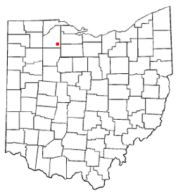
 Location of West Millgrove, Ohio | |
 Location of West Millgrove in Wood County | |
| Coordinates: 41°14′34″N 83°29′29″W / 41.24278°N 83.49139°W | |
| Country | United States |
| State | Ohio |
| County | Wood |
| Township | Perry |
| Area | |
| • Total | 0.26 sq mi (0.67 km2) |
| • Land | 0.26 sq mi (0.67 km2) |
| • Water | 0.00 sq mi (0.00 km2) |
| Elevation | 712 ft (217 m) |
| Population (2020) | |
| • Total | 131 |
| • Density | 503.85/sq mi (194.55/km2) |
| Time zone | UTC-5 (Eastern (EST)) |
| • Summer (DST) | UTC-4 (EDT) |
| ZIP code | 43467 |
| Area code | 419 |
| FIPS code | 39-83888 |
| GNIS feature ID | 2400139[2] |
West Millgrove is a village in Wood County, Ohio, United States. The population was 131 at the 2020 census.
- ^ "ArcGIS REST Services Directory". United States Census Bureau. Retrieved September 20, 2022.
- ^ a b U.S. Geological Survey Geographic Names Information System: West Millgrove, Ohio